
Qhapaq Ñan
 The Qhapaq Ñan or Inca Trail Network, was an extensive system of roads built by the Inca Empire, spanning over 30,000 kilometers. It connected various regions of the empire across modern-day Peru, Ecuador, Bolivia, Colombia, Argentina, and Chile. The network facilitated trade, communication, and military movement across diverse landscapes, including deserts and high mountain passes.
Constructed with meticulous attention to detail, the roads featured stone paving, drainage systems, and various types of paths suited to different needs. Bridges, tunnels, and steps were included to navigate the challenging Andean terrain. The system also included way stations known as tambos for supporting travelers and managing goods.
The Qhapaq Ñan played a crucial role in the administration of the Inca Empire, allowing for rapid movement of messengers, troops, and goods. It was deeply integrated into the cultural and political fabric of the empire. Today, parts of the Qhapaq Ñan are recognized as a UNESCO World Heritage Site, highlighting its historical and cultural importance.
Beginning of the Qhapaq Ñan
 Cusco, the capital of the Inca Empire, was the central hub from which the Qhapaq Ñan, or Inca Trail Network, radiated. As the political, religious, and economic center of the empire, Cusco was strategically positioned in the Andean highlands to exert control over surrounding regions.
The Qhapaq Ñan began in Cusco, with roads extending outward to connect various parts of the empire. The city’s advanced urban planning and architecture, including structures like Sacsayhuamán and the Qoricancha, reflected the Inca’s cosmological and administrative order.
Cusco’s central location allowed the Inca administration to efficiently manage and coordinate the extensive network of roads, facilitating communication, logistics, and control across the empire. Symbolically, Cusco was considered the “navel of the world,” embodying the center of the Inca universe and reflecting the importance of the road system that radiated from it.
The Routes Before Qhapac Ñan
 Before the Qhapaq Ñan, various pre-Inca cultures used local trails, chasqui routes, and regional networks. Indigenous communities had footpaths for trade and communication, while chasquis were runners who used established routes for message delivery. Civilizations like the Moche, Nazca, and Tiwanaku developed their own road systems for regional integration.
The Incas later expanded and enhanced these earlier routes into their extensive and sophisticated road network, integrating advanced engineering features and creating a cohesive system across their empire.
Tambos and Bridges
Tambos were rest stops and storage facilities on the Qhapaq Ñan, the Inca road network, while bridges, including suspension and stone types, allowed travel across rivers and canyons. Both were crucial for the efficient functioning of the Inca Empire.
Tambos
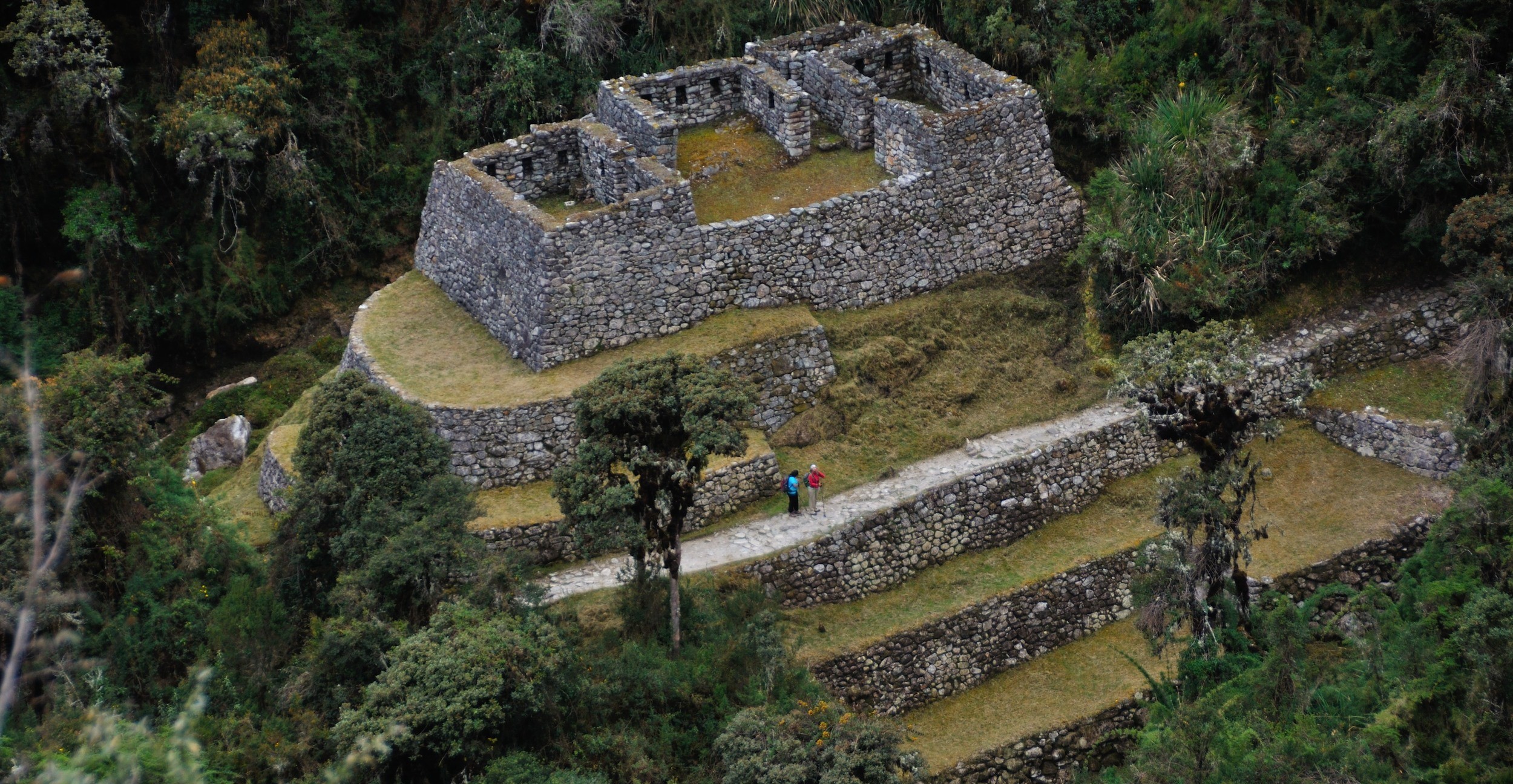 Tambos were way stations or rest areas located along the roads. They provided shelter, food, and storage for travelers and goods. Strategically placed at regular intervals, tambos facilitated the movement of people and supplies. They included lodging, storage rooms, and sometimes agricultural areas for growing food.
Tambos also served administrative functions, such as tax collection points and centers for local governance, helping the Inca manage their vast empire efficiently.
Bridges
 The Inca built various types of bridges to span rivers and gorges. Suspension bridges, made from woven grass or fiber, and beam bridges, using logs or stones, were common. Inca engineers demonstrated advanced skills in constructing durable bridges that could handle the stresses of use and natural forces.
Maintenance and repair of these bridges were regularly carried out to ensure their safety and functionality. Bridges were essential for crossing the challenging Andean terrain, connecting regions, and facilitating trade and communication across the empire.
The road to Machu Picchu
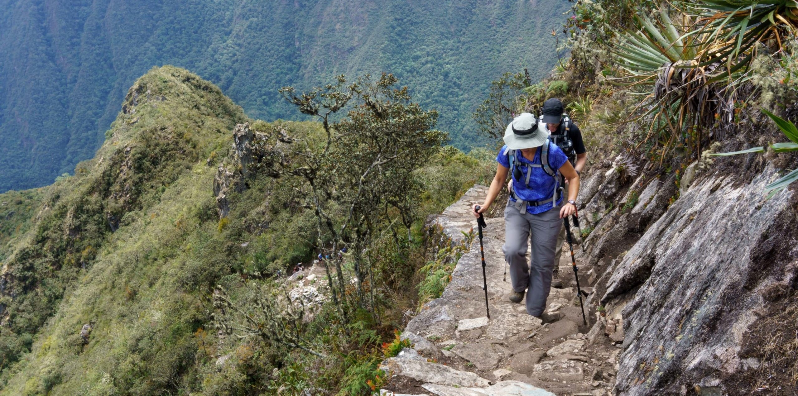 The road to Machu Picchu primarily follows the Inca Trail, a historic path extending about 43 kilometers (26 miles) from the Sacred Valley near Ollantaytambo to Machu Picchu. This renowned trekking route traverses diverse landscapes, including high-altitude passes, cloud forests, and subtropical jungle.
The trail is noted for its impressive Inca engineering, with stone-paved paths, terraced fields, and ancient stone steps. Key archaeological sites along the way include Wiñay Wayna and Phuyupatamarca. Access is regulated and typically requires a permit obtained through licensed tour operators. Trekkers usually join guided tours, which include support from porters and cooks. The trail ends at the Sun Gate (Inti Punku), offering a breathtaking first view of Machu Picchu.
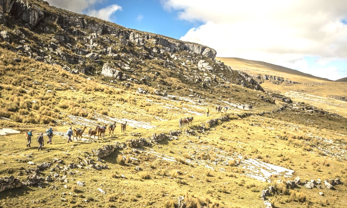 The Qhapaq Ñan was a vast and sophisticated road network that unified the Inca Empire, enabling efficient administration, trade, and communication across diverse regions. Its advanced engineering and strategic design played a crucial role in maintaining the empire’s cohesion and control.
